| 
|


Malverns Worldwide - a friendship project - PAGE 2
Malverns Worldwide
by the Friends of Malvern Springs and Wells
4 Hall Green
Malvern
Worcestershire
United Kingdom
WR14 3QX
Telephone: 01684561215
MORE ON MALVERNS WORLDWIDE
UNITED KINGDOM MALVERN LOCATIONS

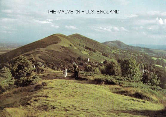
alverns of Worcestershire The Malverns are localities that lie in the shadow of the Malvern Hills. Included are Malvern Link, Malvern Common, Malvern Wells, Little Malvern, West Malvern and Great Malvern. The hills lie on the western side of England and are a substantial and distinct north-south range of hills of up to 1000 feet high. They have freedom to roam and are managed by the Malvern Hills Conservators.
alvern Worcestershire Great Malvern is the principal town on the eastern side of the Malvern Hills. It lies south-west of Worcester, the county capital. The town council coat of arms are portrayed on the passport right. Hopefully this web page will assist you by acting as your passport to exploring the Malvern Hills and its Malverns. To find out more about Great Malvern town click the title above.
alvern Link This Worcestershire Malvern name refers to the large area to the immediately north of Great Malvern and east of the northern end of the Malvern Hills. It is well developed over many years and includes commercial and residential facilities as well as a substantial High Street along the Worcester Road.
alvern Common The rural hamlet of Malvern Common lies on the eastern side of the hills at the Wyche Cutting in Worcestershire. It is a large area of open land with limited housing and is crossed north-south by the B 4208 road. At the close of the 19th century, the land around the Wyche district was being named South Malvern. This name appears to have not persisted however.

alvern Wells This watering-place location lies on the eastern side of the Malvern Hills, between the Upper Wyche cutting across the hills and the Wynds Point road crossing in Worcestershire. It is near the road along the side of the hills that gives access to the Holy Well. This was once famous for its water cure treatments and more recently bottled Malvern water.
LITTLE
alvern This location lies on the eastern side of the Malvern Hills in Worcestershire, near the Wynds Point road crossing east to west. This small hamlet is of ancient date with a former Benedictine Priory that was erected in the 12th century in the wilds of the Malvern Forest.
WEST
alvern Worcestershire. This locality is on the western side of North Hill in the Malvern Hills range. It was once a favourite place for visitors to holiday. The road B 4232 circumnavigates this western side of the hills. The land to the north of West Malvern was known for some time as North Malvern and was the location of substantial quarries
alvern Shropshire Quatt Malvern is a village parish about 4 miles south-east of Bridgnorth on the A442 road. The name Quatt supposedly originates from the Celtic word for wood, 'Coed', and a Saxon word for farm, 'Tun'. Together they formed 'Coed-ton', i.e. 'Farm in the Wood'. The village name appears in Doomsday as 'Quatone'. Eventually this was abbreviated to Quatt. The name Malvern was added in 1127 AD when King Henry 1st acted as purveyor of a Hide of Land (about 30 acres) at Quatone to the Priory of Great Malvern.
The Priory was being completed about this time and the gift was a means of funding the new establishment. Today there is a population of about 200 and the parish includes Dudmaston Hall, a listed building and estate owned by the National Trust. Over the centuries the gift of land has been controversial however the formal naming has been retained and is particularly used on official and legal documents.
alvern Warwickshire Malvern Hall is a former stately home just east of Solihull parish church in Warwickshire. It comprises an early 18th century mansion that over the years has been much altered. The Hall lies in extensive landscaped gardens that are the principal surviving local area that bears the name Malvern. Former occupants whose coats of arms are displayed on the entrance gate posts are Lewes, Greswolde and Tollemache.
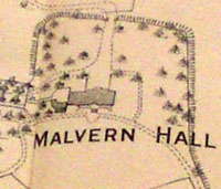
Other significant local buildings that are designated Malvern include Malvern Park Farm, also once known as Witley or Whitely and Malvern House. The late 16th century farm house lies about half a mile south of the parish church. Malvern House lies between the church and Malvern Hall. Today Malvern Hall is a girl's school and the historic farm house a private residence.
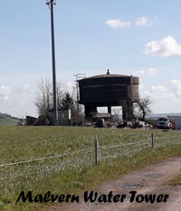
alvern Lodge The rural hamlet of Malvern Lodge lies on the crest of Chew Hill, about a mile north of the village of Chew Magna in Avon and about 8 miles south of Bristol. Two roads head north from Chew Magna and Malvern is located between these two roads. In addition Malvern Water Tower is a landmark just to the right of Chew Hill road on the crest of the hill.
Email: cora.weaver@talktalk.net (click here to send an email)
Website: Click Here
SUPPLEMENTARY INFORMATION
CLICK WEBSITE ABOVE TO GO TO PAGE ONE.

Map: (Click to View in New Window)